
AUTUMN FOG, SILVER GRASS AND STONE HUTS, Sunset Peak (大東山), Lantau Island (大嶼山), Hong Kong

At 869m above sea level, Sunset Peak (大東山) on Lantau Island (大嶼山) is the third tallest mountain in Hong Kong. Situated east of Lantau Peak (鳳凰山, 2nd tallest), and west of Lin Fa Shan (蓮花山, 6th tallest) and Yi Tung Shan (二東山, 7th tallest), Sunset Peak is at the centre of the mountainous area on the island. Sunset Peak is very popular with hikers in the autumn, when much of the mountain would be covered with golden miscanthus, or silver grass. Other than the golden grass, the mysterious stone cabins dated to the 1920’s near the summit area between Yi Tung shan and Sunset Peak also draw the attention of visitors. Probably built by foreign missionary in Southern China who came to Lantau for the annual summer retreat, the two dozen or so stone cabins known as Lantau Mountain Camp (爛頭營) reveal the once thriving retreat community on the remote mountain on Lantau.
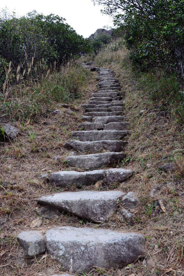
 There are numerous ways to hike up Sunset Peak. We chose to begin our walk from Nam Shan (南山) Campsite near Mui Wo (梅窩). The trail gradually went upwards with uneven stone steps.
 The miscanthus, or silver grass (芒草), started to dominate the landscape at half way up the mountain. Soon we were embraced by fog. The higher we went, the foggier it became.
 It became quite wet and misty as we approached Yi Tung Shan (二東山).
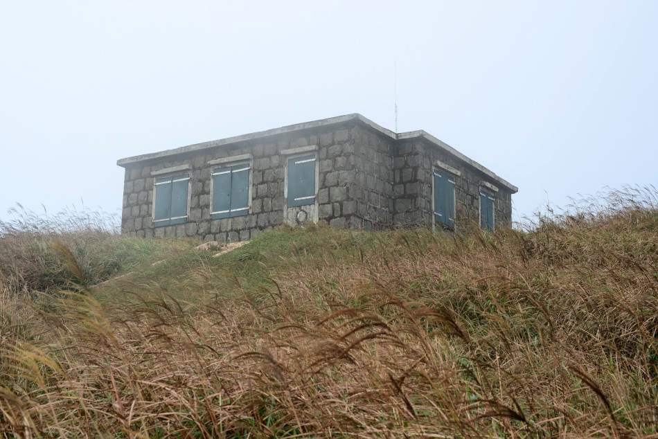
 On the route from Yi Tung Shan (二東山) to Sunset Peak (大東山), the stone cabins known as Lantau Mountain Camp (爛頭營) emerged from the fog. In the fog, it was difficult to tell how many stone cabins were actually there.
 Silver grass (芒草) was so dense in the summit area. We followed some of the narrow paths in the sea of grass to reach a few of the stone cabins.
 Some said the stone cabins were summer retreat camps of foreigners who lived in Southern China. Originally built in 1925, the cabins were damaged during the Second War World and were subsequently repaired after the war.
 After the war, the stone cabins were managed by missionary organizations and the Lantau Mountain Camp Resident’s Associations. These historical cabins are now under a new threat from the overwhelming numbers of visitors and campers who would climb on the roof for photos or leave behind piles of rubbish.
 On Sunset Peak, third tallest mountain in Hong Kong, there were no golden sunset as the name suggested. Instead, it was a unique imagery of autumn fog, silver grass and historical stone cabins.
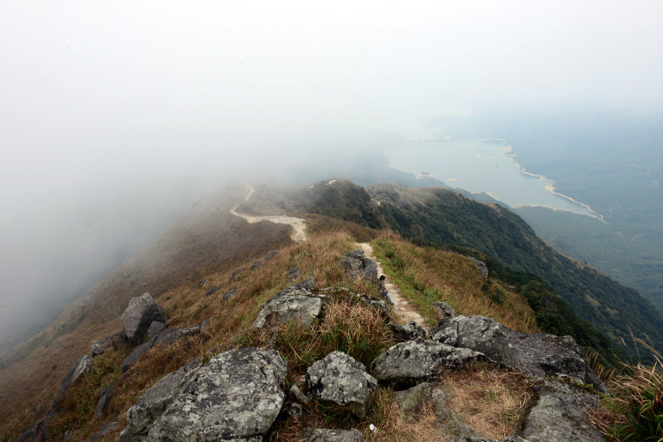
 Surrounded by the taller-than-human silver grass (芒草), it was easy to lose one’s bearings and walk in circles.
 Time was getting late. We decided to move on the trail downhill towards Pak Kung Au (伯公坳), the mountain pass between Lantau Peak and Sunset Peak.
 From then on it was all uneven steps downwards.
 It was a tiring descend until our legs started to shake a bit from time to time.
 The sky was dark and we could briefly see the coastline of Cheung Sha Beach.
 The downhill walk was dominated by the view of Lantau Peak (鳳凰山) to the west.
 A little sun break as we went for the final descend to Pak Kung Au (伯公坳).
 Despite the sun break, the summit of Lantau Peak was still concealed in thick clouds.
 Bidding farewell to the Sunset Peak, we passed by the last patch of silver grass (芒草) near Pak Kung Au (伯公坳). At Pak Kung Au, it wasn’t easy to get on a bus as most were already full. After a few packed one, we managed to hop on a bus heading to Tung Chung (東涌).
PILGRIMAGE JOURNEY ON LANTAU, Lantau Peak (鳳凰山) and Ngong Ping (昂坪), Lantau Island (大嶼山), Hong Kong

Not a particular fine day in Mid-December, but our souls yearned for a brief departure from the crowded streets and densely built-up neighborhoods of Central Hong Kong. We picked the Lantau Peak (鳳凰山) on Lantau Island. At 934m above sea level, Lantau Peak is the second highest peak in Hong Kong, and we expected there would be a considerable amount of steps to climb. After less than an hour of ferry and a bus ride, we arrived at the trailhead at Pak Kung Au (伯公坳). Known as Section 3 of the Lantau Trail (鳳凰徑), the 5.5km hike from Pak Kung Au up to Lantau Peak and then down to the Big Buddha of Ngong Ping would take about 4 hours.
 With our back facing Hong Kong’s 3rd highest peak, the Sunset Peak (大東山, 869m), we followed the signs to begin the climb of Lantau Peak.
 The climb took us less than two hours, on a mostly exposed mountain trail winding on mountain ridges until reaching the final portion of the hike which was largely uneven steps.
 Camellia (茶花) is quite a common sight when hiking in during the winter months in Hong Kong.
 The air of Hong Kong during the winter months could be quite hazy.
 On our way up, despite the haze and smog from China, we could still faintly see the beaches, Tung Chung New Town and Hong Kong International Airport below.
 The steps seemed never ended, but we pushed ourselves to go for the final assault for the summit.
 The air was much cooler as we approached the last bit of the uphill climb.
 The mountainous landscape down below was quite scenic.
 Up on the summit it was foggy, windy and cool.
 At the top platform, there was a simple shelter for wind protection, a wooden plague stating the height of the mountain, and lots of visitors taking pictures.
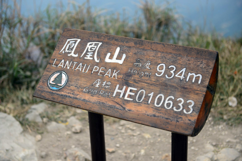 The wooden plague stating the summit of Lantau Peak at 934m.
 It was windy up there and we didn’t stay for long on the summit.
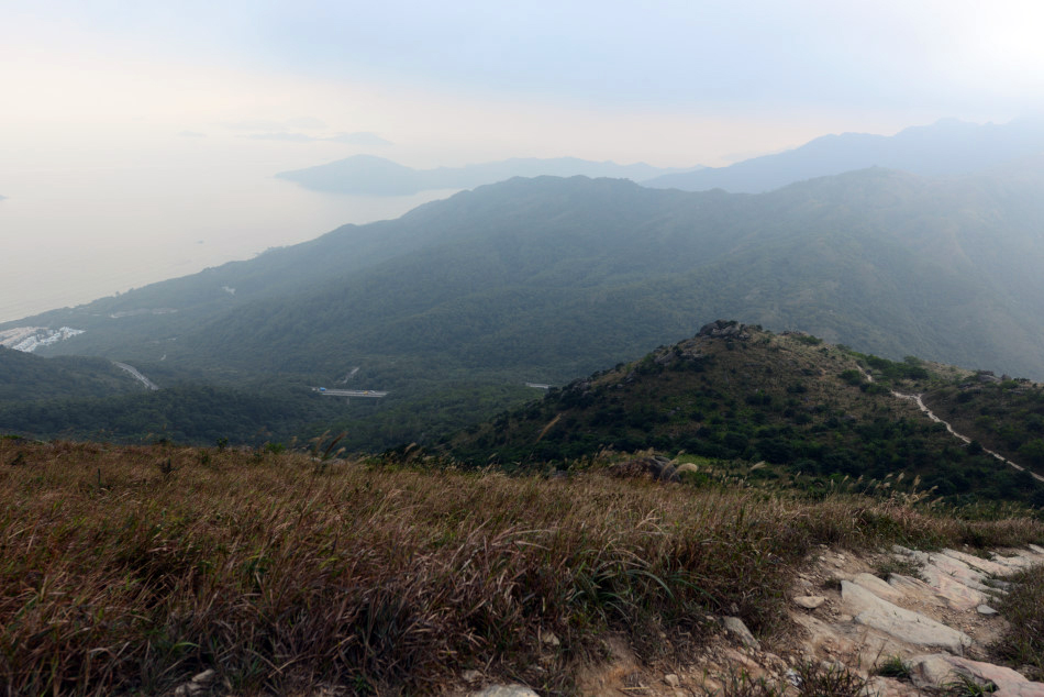
 The downhill hike towards Ngong Ping (昂坪) was uneven steps all the way down. Facing Shek Pik Reservoir (石壁水塘) in a distance, we took our time for the descend.
 The stepped trail then switched north towards Ngong Ping. We could recognize the silhouette of Tian Tan Buddha (天壇大佛), Po Lin Buddhist Monastery (寶蓮禪寺), and the sea beyond where construction of the Hong Kong-Zhuhai-Macau bridge was almost completed.
 Although we could see our destination, there was still quite a long way of steep steps to go before reaching Ngong Ping.
 The Buddha was getting bigger as we gradually walked closer to Ngong Ping.
 Reaching the gateway of “Sunrise on Lantau Peak” signified that we had reached Ngong Ping.
 After about 3 hours on the trail and just a stone throw away from Tian Tan Buddha and Po Lin Monastery, we reached a unique landscape feature known as the Wisdom Path (心經簡林).
 The Wisdom Path is consisted of large wooden columns set up in the pattern of an infinity symbol (8). On each column, text from the Heart Sutra (心經) or Mahayana Sutraare inscribed onto the wood.
 Finally we reached Tian Tan Buddha. Up on the upper platform where the Buddha sat, here were six angle-like statues handing offerings to the Buddha known as “The Offering of the Six Devas”.
 Installed in 1993, Tian Tan Buddha (天壇大佛) is a large bronze statue of Buddha Shakyamuni.
 Below the Buddha, Ngong Ping (昂坪) has been developed by the government as a tourist corridor with retail, restaurants, and entertainment businesses. We didn’t check out any of the shops. All we wanted was to catch a bus for Tung Chung, where where we could switch to the MTR (Hong Kong’s reliable metro system) for our journey home.
